


search
date/time
Sat, 1:00AM
few clouds
15.7°C
W 8mph
few clouds
15.7°C
W 8mph
 | Sunrise | 4:04AM |
| Sunset | 8:16PM |  |

Caroline Spalding
Features Correspondent
P.ublished 29th January 2022
lifestyle
Weekend Walking: To Manshead
Length: 8.8 miles
Map: OS Explorer OL 21
Difficulty: Moderate – it’s the gentle approach to the summit!
Nestled in the Ryburn Valley close to Halifax sits the village of Ripponden. Home to collection of independent shops and eateries, it is also ideally placed for walkers keen to explore the beautiful landscape of Calderdale.
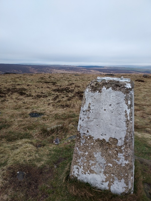
Manshead End trig point - views toward Stoodley
A wealth of pathways connect the smaller settlements surrounding Ripponden – Barkisland, Rishworth, Cotton Stones, to name but a few, and the varied terrain they cover gives broad appeal. You can trace the former railway lines, climb to moorland heights or retreat into woodland
This route climbs to one of Calderdale’s highest peaks, Manshead End, standing at 417m above sea level with terrific 360-degree views.
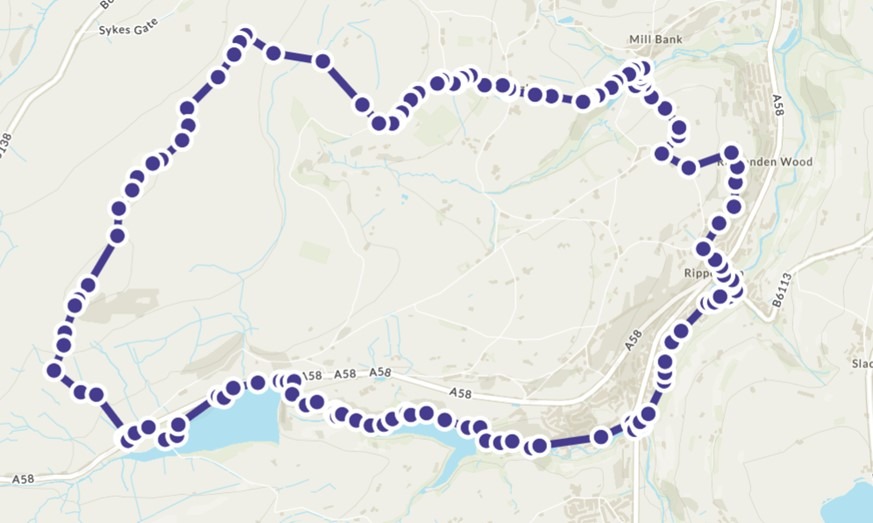
In Ripponden, the Mill Fold car park is convenient to use (just off main road, postcode HX6 4DJ). From there, walk back to the road, turn left to walk up to the junction, turning right to cross the road, then a left turn onto Royd Lane (alternative car park found here). Ascend for a short distance, and opposite the bus stop you pick up the Calderdale Way, leaving the road on the right.
You’ll follow the Calderdale Way almost all the way to Manshead, with the route clearly waymarked. It’s a beautiful section of the 50-mile circular route, and on this first part, you quickly gain height, almost without noticing - behind you you’ll look back down onto Ripponden itself, up ahead, views extend down the valley towards Sowerby Bridge.
With a farmhouse in clear view, the path turns left to ascend to the settlement of Soyland. Reaching the road, turn right, following for a short distance until the Calderdale Way leaves via a gate on the right. Follow the narrow path, continue on the track, then as the fields open up, the path turns left at the field edge towards Mill Bank.
It’s a steep descent to the hamlet, turning left at the bottom stile, then right onto the main road. Mill Bank played a key role in the woollen and silk industries, once home to five local mills. It had been threatened with demolition but was saved and made into a conservation area in the 1970s. Elements of the ruined mills can still be seen, enveloped in the woodland.
The Calderdale way leaves the main road tuning left alongside a river, and ascends through woodland to reach a more defined track. Follow this to the road, cross over and continue along Eccles Parlour, passing the Christmas Tree Farm. The Calderdale Way turns right off the road, again clearly waymarked, following a straight track, then passing into a field taking a diagonal turn.
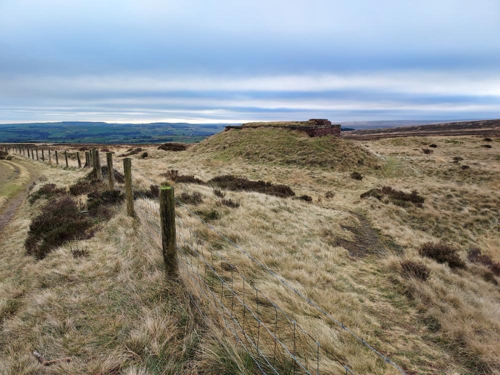
Starfish Decoy
Just beyond the decoy, turn left to follow the permissive path up onto Manshead. After a time, the path splits – here turn left, cross the small footbridge and continue to follow the clearly defined path over Little Manshead Hill and Great Manshead Hill until reaching the trig point atop Manshead End. Pause a while to take in the expansive views of the impressively dramatic landscape – to the north-west, the familiar landmark of Stoodley Pike stands tall, beckoning you to approach on another day’s walk.
Continue straight ahead beyond the trig, beginning a descent – it is clearly way marked, descending via Greenwood Clough to reach the A58 at the bottom.
Turn left, walk a short distance along the road (there is pavement) and cross over when you reach Baitings reservoir. Follow the road to the water, joining the pathway the traces the edge of the reservoir.
St the far end of the reservoir, the pathway clearly continues beyond the car park, down a fenced narrow pathway. It continues ahead as the road you’d been following does a U-turn. Just keep following as it continues to decent, ultimately reaching the waterways that feeds into Ryburn reservoir. Along the way you’ll note an interesting feature, where water appears to burst from the riverbank itself.
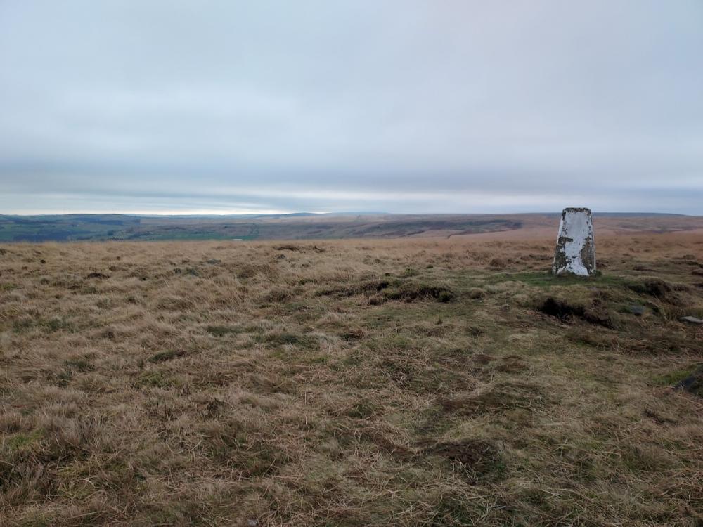
Manshead End
You meet the main road, where opposite is a blue plaque noting the former entrance to the railway station of the Rishworth Line. Descend Holme House Lane and take the riverside path back to the beginning. A beautiful end to a glorious walk.